The city
The Danube in Vienna: How a City Tamed Its River
Tony Denesa – Travel Advisor11 min read
The short version
Visitors arrive expecting the Blue Danube to flow past St. Stephen's. It does not. The river that shaped Vienna runs a few kilometres east of the old town, in a straight channel dug in the 1870s, and what you see from the centre is the Danube Canal, a narrow former arm. Understanding how that happened explains much of the city's shape.
- Danube Canal (Donaukanal): the old arm closest to the centre, lined with bars, street art and cycle paths.
- The Danube (main river): straightened between 1870 and 1875.
- Danube Island and New Danube: a flood-relief channel and a 21-kilometre island built in the 1970s and 1980s.
- Alte Donau: a cut-off arm, now a calm lake for swimming and rowing.
- Beyond the river: the districts of Floridsdorf and Donaustadt, which the Viennese half-jokingly call "Transdanubia".
A city at a river crossing
The Danube runs for roughly 2,850 km from the Black Forest to the Black Sea, and Vienna exists because of it. The Romans placed their camp of Vindobona on a terrace above the river as part of the Danube frontier. Medieval Vienna grew at the point where the river, emerging from the hills of the Vienna Woods at the Kahlenberg and Leopoldsberg, spread out across a wide plain. The town's trade depended on the water, and the little St. Rupert's Church, traditionally Vienna's oldest, stands above what was once the riverside landing.
The Danube is not the only river in Vienna's story. The city likely takes its name from the much smaller Wien river, which now flows in a stone channel through the Stadtpark before joining the Danube Canal.
An untamed river
Until the 19th century, the Danube near Vienna was not one river but a maze of shifting arms, gravel banks and wooded islands. The Prater and the Augarten were river meadows. Every spring, and often in winter when ice jammed the arms, the water threatened the suburbs; the ice flood of 1830 devastated low-lying Leopoldstadt. Bridges had to be rebuilt again and again, and shipping was unpredictable.
The great regulation (1870–1875)
After decades of debate, the imperial government, the province and the city agreed to cut a new, straight bed for the river. Between 1870 and 1875, engineers dug a channel nearly 300 metres wide east of the city, with a broad flood plain on its left bank. The old main arm, cut off at both ends, became the Alte Donau; the arm nearest the city was kept and regulated as the Danube Canal.
The regulation opened land for building. Along the new banks rose the Handelskai and its warehouses, the Nordbahn railway area and eventually new districts. The Danube Canal became a navigable waterway, and in the 1890s Otto Wagner designed the weir and lock structures at Nussdorf, where the canal leaves the main river — one of the few places where you can see Vienna 1900 architecture meet river engineering.
The 20th century: bridges, a tower and an island
The river remained a barrier. The districts on the left bank stayed semi-rural for decades, reached by only a handful of bridges. Two dates stand out.
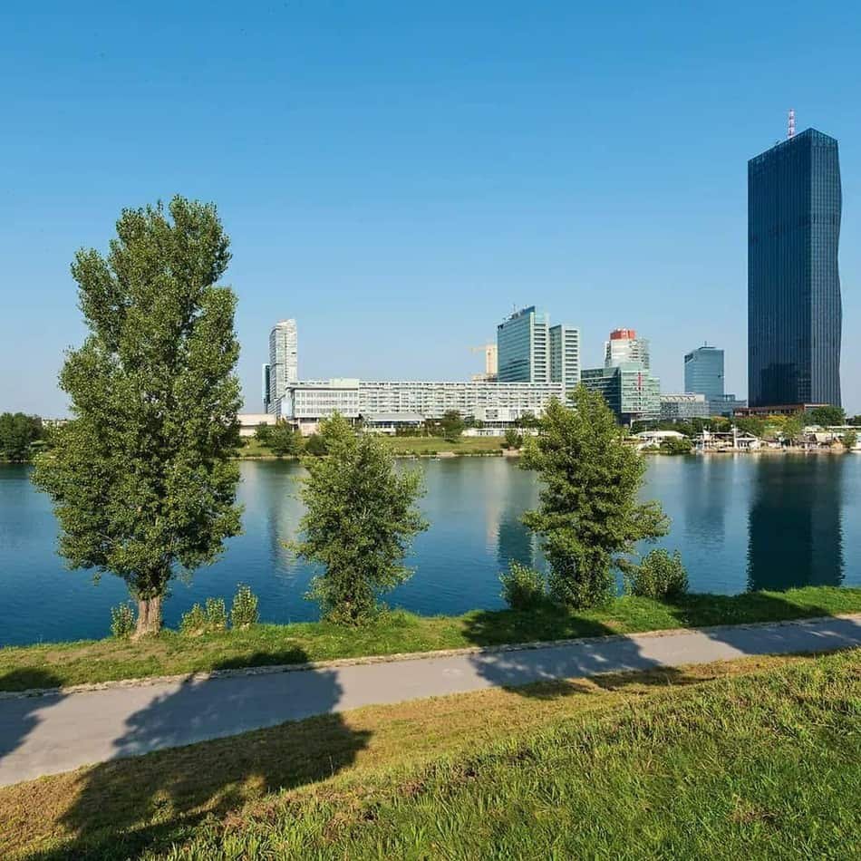
1964. For an international garden show, the city turned a former landfill and shooting range beside the river into the Donaupark and built the 150-metre Danube Tower at its centre. A decade and a half later, the UNO City (Vienna International Centre) opened next door, making Vienna one of the seats of the United Nations and pulling the city's centre of gravity across the water.
1 August 1976. Early one Sunday morning the old Reichsbrücke, the main bridge to the left bank, collapsed into the Danube. The rebuilt bridge now carries the U1 across the river, and the shock accelerated the modernisation of the whole river zone.
The Danube Island
The regulation of the 1870s had left one weakness: the flood plain on the left bank could not handle the largest floods. From 1972 to 1988 the city dug the New Danube, a relief channel parallel to the river, and piled the excavated material into the Danube Island between them, some 21 km long and only a few hundred metres wide. When the Danube rises, the weir gates open and the New Danube carries the excess water past the city. The system has kept Vienna dry during the major Central European floods of recent decades.
What began as flood protection became the city's favourite outdoor space. The Danube Island is car-free, with beaches, cycling and skating paths, barbecue areas and nudist zones. Each summer it hosts the Donauinselfest, a free open-air music festival usually held at the end of June; in 2026 it was moved to early July. The island is reached by the U1 (Donauinsel) and the U6 (Neue Donau), and the U2 crosses the river further south on the Donaustadt bridge.
The Alte Donau and the Lobau
The Alte Donau, in Donaustadt, is a calm, curved lake of former river. The Viennese swim at its lidos — the largest, the Gänsehäufel, occupies an island of its own — sail small boats, rent rowing boats and, in hard winters, sometimes skate on it. Lakeside restaurants such as Das Bootshaus make it a summer evening destination.
Further downstream, the Lobau is Vienna's share of the Donau-Auen National Park, one of the last large intact floodplain forests in Central Europe. It is a place of old river arms, herons and beavers, reachable by bus from the U-Bahn — and a reminder of what the whole Viennese Danube looked like before the engineers arrived.
The Danube Canal today
For decades the canal was a neglected, concrete-lined edge. Since the 2000s its banks have filled with summer bars, beach decks, restaurants and some of Vienna's best street art. On a warm evening, walk from Schwedenplatz towards the Rossauer Lände, or eat at Otto am Donaukanal on the Leopoldstadt side. The canal is also where the city boats and the Twin City Liner leave; our Danube cruise guide explains which cruises are worth it.
"The Blue Danube"
Johann Strauss II wrote *An der schönen blauen Donau* in 1867, after the empire's defeat by Prussia, when the city needed cheering up. The river has never been particularly blue — it is usually green-grey or brown — but the waltz became Austria's unofficial anthem and ends the New Year's Concert every year. The story of the music is told in music in Vienna.
Seeing the Danube for yourself
- From above: the Danube Tower, or the Kahlenberg viewpoint, where the whole river system spreads out below you.
- On the water: the Twin City Liner to Bratislava, or the boats of the Wachau, the most beautiful stretch of the Austrian Danube.
- On foot or by bike: the Danube Island, end to end, or the Prater's Hauptallee towards the river.
- For a swim: the Alte Donau in July and August. Check the weather first.
Where to stay nearby
Live prices and availability on a map centred on this exact spot — hotels, apartments and hostels, so you can judge the walk from here rather than guess from an address.
Bookings made through this map earn us a commission. Your price is unaffected.